A selection of walking routes on Pembrokeshire Coast
Pembrokeshire Coast offers such stunning scenery, it seems a shame to speed past it. So why not take in this wonderful area of Wales on two feet? We’ve compiled a list of 10 walking routes for all abilities for you to try.
There are two options of map; OS Explorer has a scale of 1:25 000 and OS Landranger has a scale of 1:50 000. OS Explorer is more zoomed in and offers greater detail and information, but the OS Landranger covers a greater area.
If you’re planning you’re own route, but you’re not sure which map you need, then check out our Ordnance Survey online map finder here!
1. St Dogmaels to Newport, Pembrokeshire Coast, Wales
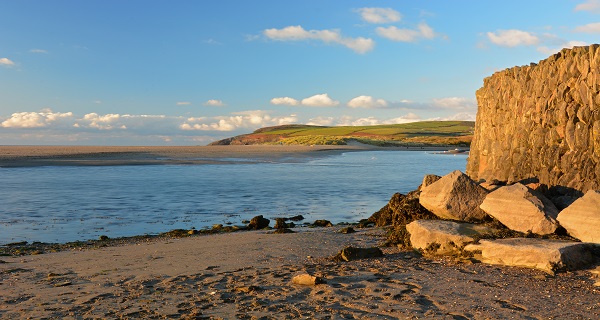

The Pembrokeshire Coast Path is one of the longest walking routes in the UK covering a grand total of 186-miles. Obviously, this walk is going to take days to complete and is definitely one for the more experienced walkers, but for those looking to tackle a section of it during your stay in the National Park, the route between St. Dogmaels and Newport will provide plenty to see and takes in various hills and valleys along the 17-mile stretch. The rugged coastline makes it a difficult route but one that can certainly be tackled in one go depending on your ability (and the weather!)
- Grade: Moderate
- Terrain: Open, Coastal
- Distance: 27.45 km | Approx. Time: 8:45 hours (one way)
Maps to purchase for this route: OS Explorer OL35: North Pembrokeshire / Gogledd Sir Benfro
OS Landranger 145: Cardigan & Mynydd Preseli/Aberteifi a Mynydd Preseli
You can download the route for this walk here.
2. Tenby to Saundersfoot, Pembrokeshire Coast, Wales

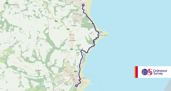
This fabulous jaunt connects the dots between the two most popular resorts on the south Pembrokeshire coast: Saundersfoot and Tenby. Starting off in Saundersfoot, you’ll embark on a journey along a breath-taking, and often well-wooded section of the coastal path. As you progress, get ready for jaw-dropping views of Tenby, a charming and captivating town that’s just begging to be explored once you reach the finish line. On weekdays and Saturdays, hop on a bus between Tenby and Saundersfoot, and on Sundays, let the train whisk you away. Lace up those walking shoes and get ready for a South Pembrokeshire adventure that’s equal parts scenic and convenient!
- Grade: Easy
- Terrain: Open, Coastal
- Distance: 6.79 km | Approx. Time: 2:12 hours (one-way)
Maps to purchase for this route: OS Explorer OL36: Alnwick & Amble – South Pembrokeshire / De Sir Benfro
OS Landranger 158: Tenby & Pembroke/Dinbyc-ypysgod a Penfro
You can download the route for this walk here.
3. The Golden Road: Preseli Ridge, Pembrokeshire Coast, Wales
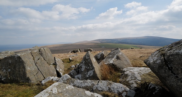
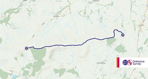
This particular route takes you to the highest point in the Preseli Hills with spectacular views that stretch on and on for miles on clear days. Due to the nature of this walk it’s best to be a relatively experienced walker, although there are guided walks available if you’d prefer to go out with a local expert who can talk you through some of the sights and the history of the area. One of the best historical walks as well as a great choice for sightseeing, walkers will come across an Iron Age fort about halfway through the 6.4 mile walk.
- Grade: Moderate
- Terrain: Open, Hill, Moorland
- Distance: 10.45 km | Approx. Time: 4:00 hours (one-way)
Maps to purchase for this route: OS Explorer OL35: North Pembrokeshire / Gogledd Sir Benfro
OS Landranger 145: Cardigan & Mynydd Preseli/Aberteifi a Mynydd Preseli
You can download the route for this walk here.
4. Moylgrove to Newport, Pembrokeshire Coast, Wales

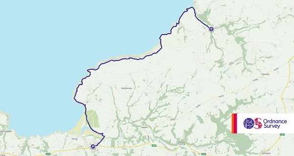
If you like coastal walks then they don’t come much better in this particular area. Considering that the whole park is based around a coast that’s some statement, but the 10-mile walk between Moylegrove and Newport is truly spectacular with fantastic views out to sea as well as inland. Walkers will see the famous Witches Cauldron and head through Ceibwr Bay. The whole walk should take around 5 hours depending on your ability, and there are some very steep sections which is worth noting before heading off.
- Grade: Moderate
- Terrain: Open, Coastal
- Distance: 14.65 km | Approx. Time: 4:50 hours (one-way)
Maps to purchase for this route: OS Explorer OL35: North Pembrokeshire / Gogledd Sir Benfro
OS Landranger 145: Cardigan & Mynydd Preseli/Aberteifi a Mynydd Preseli
You can download the route for this walk here.
5. Dinas Island, Pembrokeshire Coast, Wales
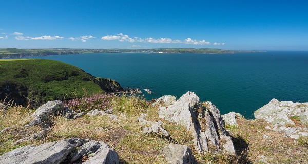
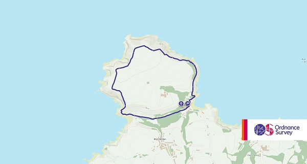
There is a lot of scenery packed into this 3-mile short walk around Dinas Island. Long distance walks aren’t for everybody, and sometimes you might not be prepared for a walking holiday but you go where the mood takes you. If this sounds like your family then this is the Pembrokeshire National Park walk for you. It is a 1-2 hour circular route that’s completely dog-friendly too. While there are a couple of steep inclines along the way, it’s a relatively easy walk to blow off some cobwebs and see the scenery.
- Grade: Easy
- Terrain: Open, Coastal
- Distance: 4.80 km | Approx. Time: 1:30 hours
Maps to purchase for this route: OS Explorer OL35: North Pembrokeshire / Gogledd Sir Benfro
OS Landranger 145: Cardigan & Mynydd Preseli/Aberteifi a Mynydd Preseli
You can download the route for this walk here.
6. Foel Eryr, Pembrokeshire Coast, Wales
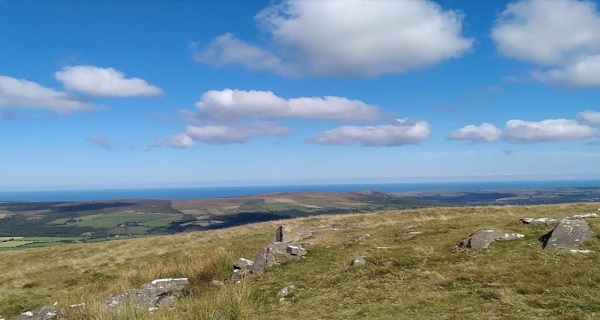

Another popular short walk in the area, Foel Eryr is perfect for novice walkers who don’t own plenty of equipment or specialist walking shoes. It takes less than an hour to complete which is perfect for families packing a lot into a short break in the National Park and it’s another walk that is pet-friendly. There is quite a steep incline but the sea views from the top make it worthwhile, just prepare yourselves for the stiff breeze on windy days.
- Grade: Easy
- Terrain: Open,Hill
- Distance: 1.95 km | Approx. Time: 0:40 hours
Maps to purchase for this route: OS Explorer OL35: North Pembrokeshire / Gogledd Sir Benfro
OS Landranger 145: Cardigan & Mynydd Preseli/Aberteifi a Mynydd Preseli
You can download the route for this walk here.
7. Foel Dyrch, Pembrokeshire Coast, Wales
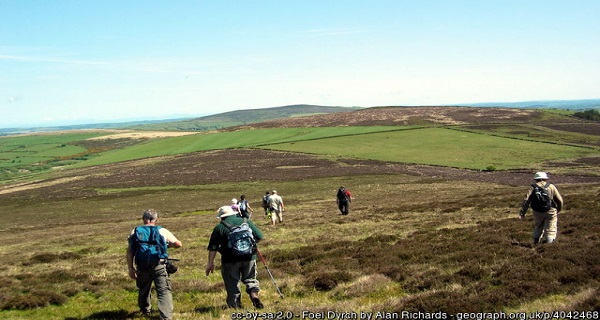

The Foel Dyrch walk is one for experienced walkers and those willing to dedicate most of their day to completing the section of the coastline. Covering a distance of 10 miles it’s only a moderate walk in terms of difficulty, but that can vary according to the weather conditions. The ground can become quite unstable in the wet and there’s plenty of mud to slow you down. On a good day you can expect it to take between three and four hours but go prepared for any weather as you’re a long way from your campsite or hotel if you get caught out by the rain.
- Grade: Moderate
- Terrain: Open,Hill
- Distance: 16.00 km | Approx. Time: 4:45 hours
Maps to purchase for this route: OS Explorer OL35: North Pembrokeshire / Gogledd Sir Benfro
OS Landranger 145: Cardigan & Mynydd Preseli/Aberteifi a Mynydd Preseli
You can download the route for this walk here.
8. St David’s, Porth Clais, and Ramsey Sound, Pembrokeshire Coast, Wales
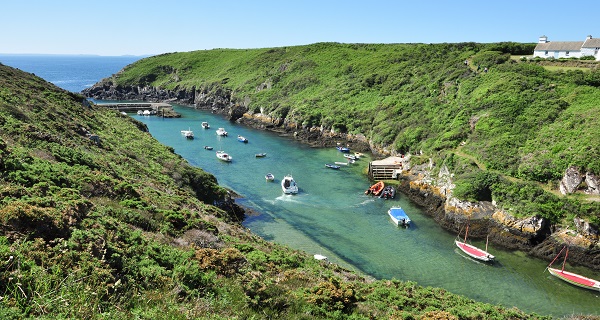

From the delightful town of St. David’s, it’s just a mere half-mile (800 metres) to the coast, and then the real adventure begins! The path will take you on a journey from the enchanting St. Non’s Bay to the picturesque Porthstinian. Brace yourself for a wild, breathtaking, and wonderfully solitary stretch of shoreline which is also relatively easy for walking with its well-marked path and just a handful of modest ascents and descents.
As you amble along, you’ll catch glimpses of the majestic St. David’s Cathedral tower, which stands as a testament to centuries of history. And if that’s not enough to pique your interest, there’s a treasure trove of medieval wonders in St. David’s town itself! Plus, you’ll stumble upon various spots along the way that are steeped in the legacy of the Welsh patron saint. It’s like a scenic smorgasbord of history and architecture. So, take your time, soak it all in, and be sure to leave room for some hearty exploration!
- Grade: Moderate
- Terrain: Open,Coastal
- Distance: 14.65 km | Approx. Time: 4:15 hours
Maps to purchase for this route: OS Explorer OL35: North Pembrokeshire / Gogledd Sir Benfro
OS Landranger 157: St Davids & Haverfordwest/Tyddewi a Hwlffordd
You can download the route for this walk here.
9. Newport Millennium Trail, Pembrokeshire Coast, Wales
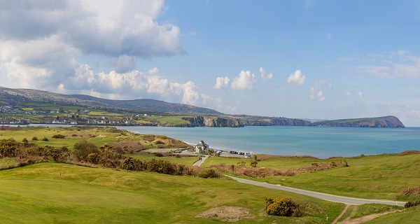

To celebrate the millennium back in 2000 the Newport Millennium Trail was opened to attract walkers to the area and it has gone on to become one of the most popular in the National Park. It is a circular route that starts and ends in Newport with walkers taking on a near 4.5mile loop through wooded, mountainous terrain. It’s a walk that is suitable for beginners right through to more experienced walkers but one that the whole family can enjoy.
- Grade: Easy
- Terrain: Open
- Distance: 7.20 km | Approx. Time: 2:10 hours
Maps to purchase for this route: OS Explorer OL35: North Pembrokeshire / Gogledd Sir Benfro
OS Landranger 145: Cardigan & Mynydd Preseli/Aberteifi a Mynydd Preseli
You can download the route for this walk here.
10. Manorbier, Pembrokeshire Coast, Wales


Many describe The Golden Road as the most picturesque in the country and The medieval Welsh churchman Giraldus Cambrensis, who was born at Manorbier in 1146, described the village as ‘the pleasantest spot in Wales’. Walkers can judge this for themselves on this ramble that takes in a short and relatively easy section of the coast path on the east of Manorbier Bay before returning, via field paths and tracks, to the village with its twin historic attractions of medieval church and castle. There are plenty of gentle undulations but nothing too strenuous so all abilities would be able to tackle it, just be sure to take durable walking boots with you as the long walk can take its toll on some.
- Grade: Easy
- Terrain: Open,Coastal
- Distance: 4.45 km | Approx. Time: 1:25 hours
Maps to purchase for this route: OS Explorer OL36: Alnwick & Amble – South Pembrokeshire / De Sir Benfro
OS Landranger 158: Tenby & Pembroke/Dinbyc-ypysgod a Penfro
You can download the route for this walk here.
Before setting off on your adventure, ensure you have everything you need! From waterproofs and walking boots, to hydration packs and walking poles, here at Go Outdoors we have everything you need for all your outdoor pursuits.
Looking for more inspiration? Head to our blog to read more unbeatable content from us!
