10 tips for taking in Snowdonia on foot
From gentle strolls to challenging hikes, there’s a walk to suit all abilities in Snowdonia. Check out this blog to see our favourite 10 walking routes to enjoy!
There are two options of map; OS Explorer has a scale of 1:25 000 and OS Landranger has a scale of 1:50 000. OS Explorer is more zoomed in and offers greater detail and information, but the OS Landranger covers a greater area
If you’re planning you’re own route, but you’re not sure which map you need, then check out our Ordnance Survey online map finder here!
1. Barmouth Full Tour Circular Walk

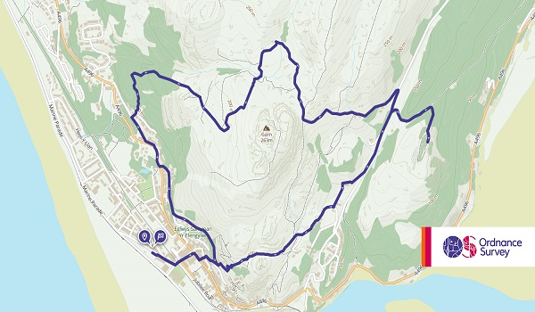
- Grade: Moderate
- Terrain: Open, Hill, Woodland
- Distance: 7.10 km | Approx. Time: 2:25 hours
With so much to see along the way, many people prefer to split this route into two. Heading along sections of the famous Panorama Walk, you’ll be rewarded with views of Barmouth Bridge. Discover the rich history of the area with several monuments and sculptures, and buildings of interest en-route.
Maps to purchase for this route: OS Explorer OL23: Cadair Idris & Llyn Tegid / OS Landranger 124: Porthmadog & Dolgellau
You can download the route for this walk here.
2. The Welsh Three-Thousanders Walk


- Grade: Severe
- Terrain: Mountain, Open
- Distance: 50.20 km | Approx. Time: 27:40 hours (one-way)
If you’re feeling brave, why not tackle the Welsh Three-Thousanders, a challenging walk stretching across 51km. With a total of 15 summits and 3606m ascent, it’s a chance for experienced walkers to test themselves. It’s well worth it though, just to take on Carneddau, Crib Goch, the Glyders, Snowdon and Tryfan all on the same day.
Maps to purchase for this route: OS Explorer OL17: Snowdon / Yr Wyddfa
OS Landranger 115: Snowdon/Yr Wyddfa
You can download the route for this walk here.
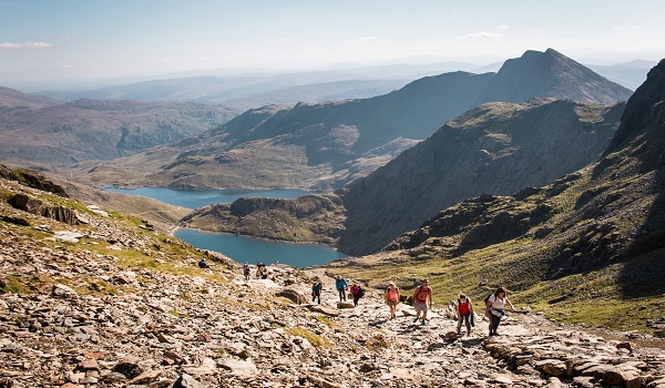
3. The Snowdon Horseshoe
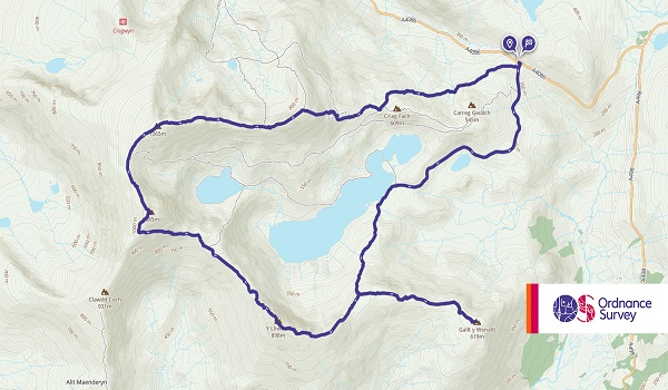
- Grade: Difficult
- Terrain: Mountain, Open
- Distance: 14.70 km | Approx. Time: 5:55 hours
With a combination of steep slopes and exposure to the elements, the Snowdon Horseshoe is sure to get your pulse racing. Dubbed ‘the best ridge walk in Wales’, this 11km route is not suitable if you have a fear of heights. It takes up to six hours to complete so you might want to pack some refreshments for the journey.
Maps to purchase for this route: OS Explorer OL17: Snowdon / Yr Wyddfa
OS Landranger 115: Snowdon/Yr Wyddfa
You can download the route for this walk here.
4. Penmaenmawr


- Grade: Moderate
- Terrain: Open, Hill
- Distance: 8.60 km | Approx. Time: 2:55 hours
Starting from Llanfairfechan promenade, this 10km walk offers a mixture of firm, grassy paths and steep ascents and descents. Step back in time as you pass ancient enclosures and stone circles that pre-date the Roman invasion. If it’s a clear day, be sure to look out for the Lake District mountains in the distance. Allow three hours to complete this route.
Maps to purchase for this route: OS Explorer OL17: Snowdon / Yr Wyddfa
OS Landranger 115: Snowdon/Yr Wyddfa
You can download the route for this walk here.
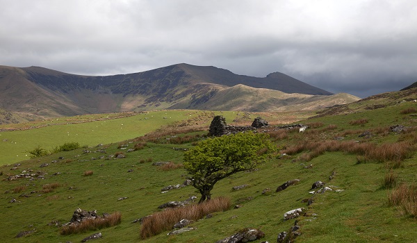
5. Cwm Trwsgl from Cwm Pennant

- Grade: Moderate
- Terrain: Woodland
- Distance: 10.90 km | Approx. Time: 3:15 hours
Snowdonia still has a few secrets tucked away, and Cwm Pennant is certainly one of them. This short walking route takes in the old Cwm Trwsgl quarries, and gives you the opportunity to explore the disused quarry barracks. Note that there are open quarry workings here that require care. Head back along the old tramway that contours along the valley sides, before an easy return on a country lane.
Maps to purchase for this route: OS Explorer OL17: Snowdon / Yr Wyddfa
OS Landranger 115: Snowdon/Yr Wyddfa
You can download the route for this walk here.
6. Crib Goch to Snowdon


- Grade: Difficult
- Terrain: Mountain, Open
- Distance: 5.05 km | Approx. Time: 2:45 hours (one-way)
If you’re one for a challenge, then Crib Goch may be just the route for you. Not one for novice walkers, it’s a thrilling combination of grade one scrambling, steep slopes and slippery rock. Tackle three summits in one day: Crib Goch, Garnedd and Snowdon. It is not recommended to attempt this route in wet weather conditions or during the winter unless very experienced and equipped with crampons and ice axes.
Maps to purchase for this route: OS Explorer OL17: Snowdon / Yr Wyddfa
OS Landranger 115: Snowdon/Yr Wyddfa
You can download the route for this walk here.
7. Snowdon Ranger Path
- Grade: Moderate
- Terrain: Mountain, Open
- Distance: 6.30 km | Approx. Time: 3:10 hours (one-way)
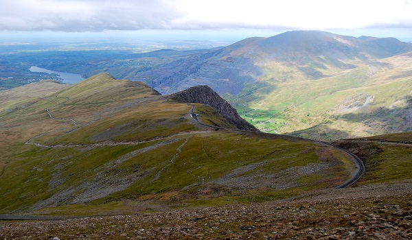
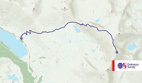
Quieter than most routes up Snowdon, be prepared to gain height quickly as you zig-zag your way up the mountain from the Snowdon Ranger Youth Hostel. With stunning views from the top, be sure to reward yourself after all that upward climbing with a pint of ale from the pub in Rhyd Ddu.
Maps to purchase for this route: OS Explorer OL17: Snowdon / Yr Wyddfa
OS Landranger 115: Snowdon/Yr Wyddfa
You can download the route for this walk here.
8. The Pyg and Miners Tracks

- Grade: Moderate
- Terrain: Mountain, Open
- Distance: 11.95 km | Approx. Time: 4:20 hours
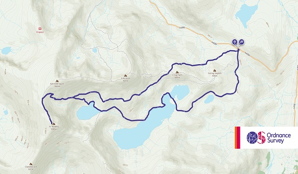
Keep to the Pyg track and you’ll find this route up Snowdon fairly straightforward. Take care where the top of the track joins Llanberis path – lingering ice can be treacherous. Descend the steep slope of the Miners track, passing old houses where the miners used to live. This 11km route should take around five hours to complete so it’s recommended to take some food and plenty of water to keep you sustained.
Maps to purchase for this route: OS Explorer OL17: Snowdon / Yr Wyddfa
OS Landranger 115: Snowdon/Yr Wyddfa
You can download the route for this walk here.
9. Rhyd Ddu to Beddgelert
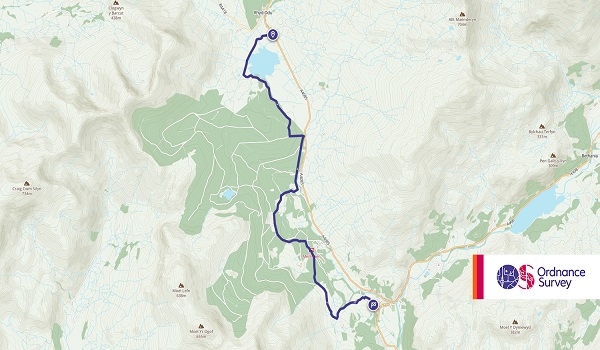
- Grade: Easy
- Terrain: Woodland, Open
- Distance: 7.60 km | Approx. Time: 2:05 hours (one-way)
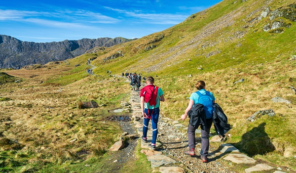
If you’re happy about heights and you have a good level of fitness, you’ll love this popular route up Snowdon. Once you reach the base of the mountain, there are two ascents available: take the Pyg track for an easier climb or if you’re feeling up to the challenge, Crib Goch boasts nail-biting ridge walking and tough scrambling – the choice is yours.
Maps to purchase for this route: OS Explorer OL17: Snowdon / Yr Wyddfa
OS Landranger 115: Snowdon/Yr Wyddfa
You can download the route for this walk here.
10. Dôl Idris

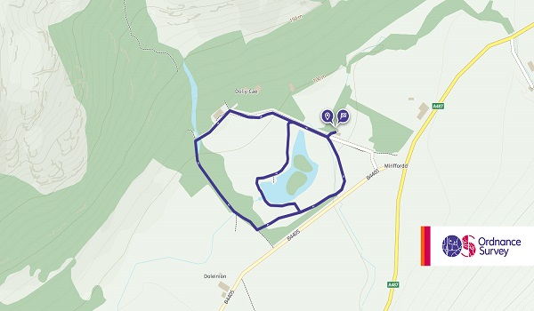
- Grade: Easy
- Terrain: Open
- Distance: 1.45 km | Approx. Time: 0:25 hours
Follow this flat circular path donated to the National Park Authority in the early 1980s by Mr Ivor Idris. Suitable for everyone, this short route gives you the chance to sample the stunning scenery of Snowdonia. Pop in to the tea room and visitor centre or bring a packed lunch and take advantage of the picnic tables dotted along the path.
Maps to purchase for this route: OS Explorer OL23: Cadair Idris & Llyn Tegid /
OS Landranger 124: Porthmadog & Dolgellau
You can download the route for this walk here.
Make sure you have everything you need for your walking trip! Here at Go Outdoors we stock plenty of clothing and equipment for walking and hiking.
Looking for more inspiration? Head to our blog to read more unbeatable content from us!
