Head for the coast with these bracing coastal walks in the UK
Coastal walks aren’t just relaxing, they’re a nice break from the mountains and hills. A walk in the sea air is said to make you sleep for longer, but more than anything – coastal walks offer up some stunning views as well. Here we have selected 15 areas of coastline around the UK, and a walk for you to enjoy them.
Below you will find the information for these 15 coastal walks, along with the appropriate map to guide you along and the route to download, so you can plan your walk with confidence!
There are two options of map; OS Explorer has a scale of 1:25 000 and OS Landranger has a scale of 1:50 000. OS Explorer is more zoomed in and offers greater detail and information, but the OS Landranger covers a greater area.
If you’re planning you’re own route, but you’re not sure which map you need, then check out our Ordnance Survey online map finder here!
1. Craster, Northumberland, England

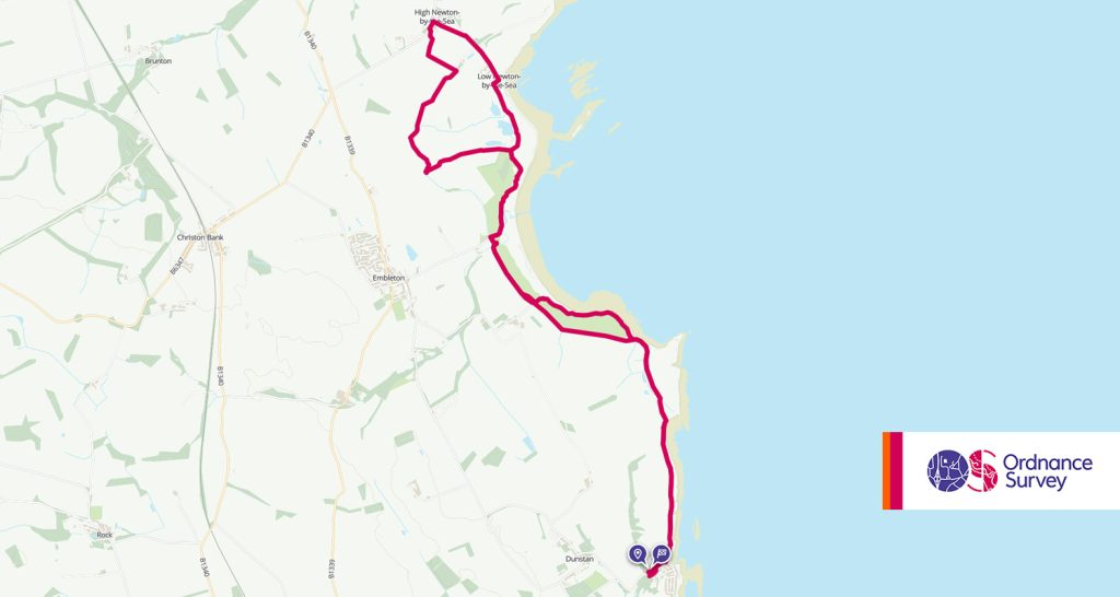
- Grade: Easy
- Terrain: Open, Coastal
- Distance: 15.45 km | Approx. Time: 4:15 hours
The walk from the village of Craster to Low Newton takes in some of the picturesque coastline in Northumberland. Along the route you’ll be met with the ruins of Dunstanburgh Castle as well as the fantastic beach of Embleton Bay. Wildlife fans may also be interested in Newton Pool nature reserve enroute.
Maps to purchase for this route: OS Explorer 332: Alnwick & Amble / OS Landranger 81: Alnwick & Morpeth
You can download the route for this walk here.
2. Old Harry Rocks, Dorset, England

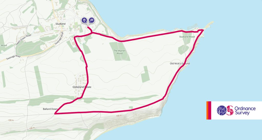
- Grade: Moderate
- Terrain: Open, Coastal
- Distance: 6.10km | Approx. Time: 1:50 hours
One of the best ways to take in the simply stunning Jurassic Coast in Dorset. Recently featured on Julia Bradbury’s ‘Britain’s Best Walks’, this section of the South West Coastal path offers sea views and interesting rock formations. Old Harry refers to the chalk formation furthest out to sea in this area and is said to be named after famed local pirate Harry Paye.
Maps to purchase for this route: OS Explorer OL15: Purbeck & South Dorset / OS Landranger 195: Bournemouth & Purbeck
You can download the route for this walk here.
3. Sandwood Bay, Sutherland, Scotland

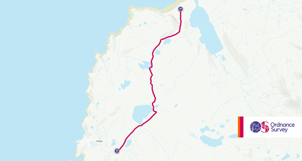
- Grade: Easy
- Terrain: Open, Coastal
- Distance: 6.65km | Approx. Time: 1:55 hours
Sandwood Bay may be one of the nicest beaches in Britain, and a beach that even when busy, never truly *feels* busy, likely due to there being no facilities at this beach and no car park to reach it directly. This walk will take you from Blairmore to the rewarding views of the beach over an 8 mile+ walk over moorland track.
Maps to purchase for this route: OS Explorer 446: Durness & Cape Wrath / OS Landranger 9: Cape Wrath
You can download the route for this walk here.
4. Holyhead, Anglesey

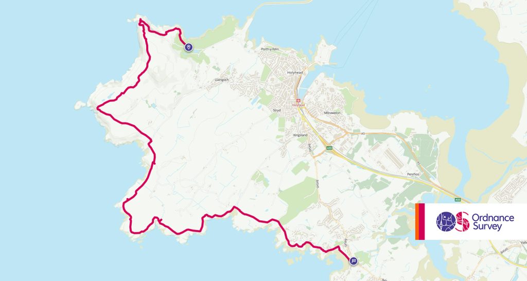
- Grade: Moderate (distance)
- Terrain: Open, Coastal
- Distance: 14km | Approx. Time: 4:20 hours
The little island of Anglesey off the North of Wales is a wealth of walks and things to do. Anglesey also has a 125 mile coastal path around the edge which can be broken down into a number of routes to try over a holiday. Our favourite is the route from Holyhead to Trearddur Bay, arguably the prettiest section of the coastal path. This walk will take you up Holyhead mountain and leading to the fantastic photo opportunity that is South Stack Lighthouse. With areas of the walk owned by the RSPB, it’s a great walk for bird watchers or wildlife fans.
Maps to purchase for this route:
OS Explorer 262: Anglesey West / Gorllewin Ynys Mon
OS Landranger 114: Anglesey/Ynys Mon
You can download the route for this walk here.
5. Causeway Coast Way, Northern Ireland

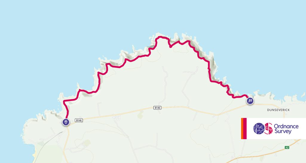
- Grade: Moderate
- Terrain: Open, Coastal
- Distance: 7.75km | Approx. Time: 4:50 hours
The Causeway Coast Way is a 33 mile section of walk in County Antrim will take you from Portstewart to Ballycastle. Along the way you’ll pass castles, areas of outstanding natural beauty, bays and beaches and of course the Giant’s Causeway that gives the path it’s name. While the whole path is 33 miles long, it is handily split into smaller more manageable chunks for those who don’t wish to take on the whole thing. Section 4 which goes from Giant’s Causeway to Dunseverick Castle is a 7km section that is ideal for sightseers, or section 6 which features the rope bride to Carrick-a-Rede Island shown in the photo above.
You can download the route for this walk here.
6. Whitehaven, Cumbria, England

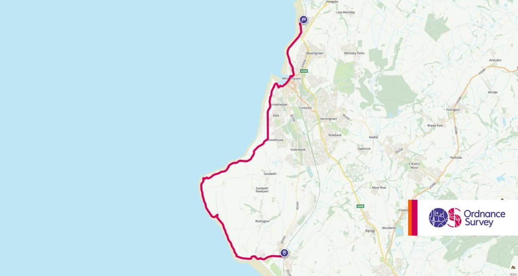
- Grade: Moderate (distance)
- Terrain: Open, Coastal
- Distance: 14.25km | Approx. Time: 4:25 hours
The walk from St Bees to Whitehaven takes in some of the best coastline in Cumbria. Part of the Cumbrian Coastal Way and the English Coast Path, this walk isn’t a leisurely stroll and will test you in places. Along the route you will cross points of interest like St Bees Head (An RSPB nature reserve, ideal for birdwatchers), the remnants of past industry and head toward the simply beautiful town of Whitehaven.
Maps to purchase for this route: OS Explorer 303: Whitehaven & Workington / OS Landranger 89: West Cumbria
You can download the route for this walk here.
7. Norfolk Coast Path, Norfolk, England

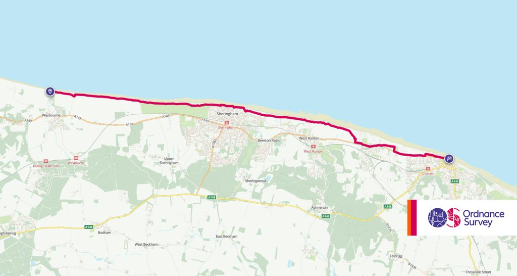
- Grade: Easy
- Terrain: Open, Coastal
- Distance: 11.90km | Approx. Time: 3:40 hours
The Norfolk Coast is a recognised area of outstanding natural beauty, so you can assume the Norfolk Coast path takes you through some incredible scenery along the edge of England. While the whole coastal path is over 60 miles long, we’d recommend the section between Weybourne and Cromer, if you were just looking for a long day walk.
Along the way you’ll pass many World War II relics including pill boxes, an old military base (now a museum), gun bases and more as you walk along Weybourne Cliffs to Sheringham and on to stunning Cromer.
Maps to purchase for this route: OS Explorer 252: Norfolk Coast East / OS Landranger 133: North East Norfolk
You can download the route for this walk here.
8. Bullers of Buchan, Aberdeenshire, Scotland

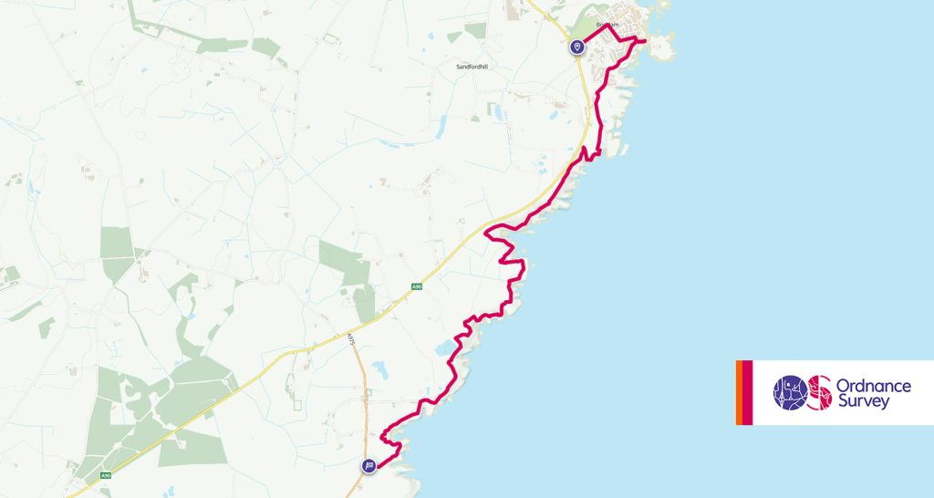
- Grade: Moderate
- Terrain: Open, Coastal
- Distance: 8.65km | Approx. Time: 2:45 hours
The Bullers of Buchan is some of the finest area of coastline in Aberdeenshire. You can choose to start your walk there and head to Boddam, or for a longer walk, it’s worth starting a little lower at Cruden Bay. Aside from the stacks, arches and caves of the Bullers of Buchan, along the way you can see plenty of caves, the ruin of Castle Boddam and the Buchanness Lighthouse.
The area is also rich in wildlife with many sea birds to be seen, along with seals and porpoise.
Maps to purchase for this route: OS Explorer 427: Peterhead & Fraserburgh / OS Landranger 30: Fraserburgh
You can download the route for this walk here.
9. Three Cliffs Bay, Gower, Wales

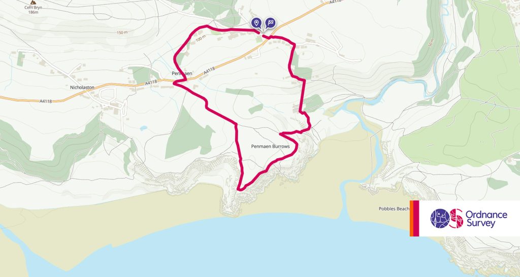
- Grade: Easy
- Terrain: Open, Coastal
- Distance: 3.35km | Approx. Time: 1:10 hours
The Wales Coast Path as far as we’re concerned is a treat pretty much all the way around, so picking out certain walks is difficult. For this walk it’s an easy sub-3 mile circular walk from Penmaen to Three Cliffs Bay that everybody can enjoy. The walk offers fantastic views of Three Cliffs Bay, along with church ruins and Pennard Castle along the route that contains long stretches of sandy beaches. You’ll also see a view of the Devon coast.
Maps to purchase for this route:
OS Landranger 159: Swansea & Gower/Abertawe a Gwyr
You can download the route for this walk here.
10. Durdle Door & White Nothe, Dorset, England

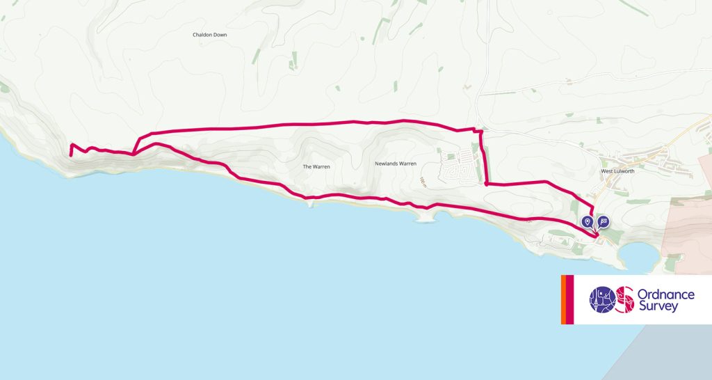
- Grade: Difficult
- Terrain: Open, Coastal
- Distance: 11.50km | Approx. Time: 3:55 hours
It’s difficult to imagine an article about the coast without including the famous Durdle Door. A truly stunning area of the South West Coast Path in Dorset and one that will take your breath away. The walk with take you to Durdle Dar and Lulworth Cove, it’s also recommended as a good walk for dogs as they are allowed on the beaches on these locations. Featuring views of sea stacks, chalk cliffs and all the interesting shapes that the sea has carved out of England since the Jurassic period.
Maps to purchase for this route: OS Explorer OL15: Purbeck & South Dorset / OS Landranger 194: Dorchester & Weymouth
You can download the route for this walk here.
11. The Mull of Galloway, Dumfries & Galloway, Scotland

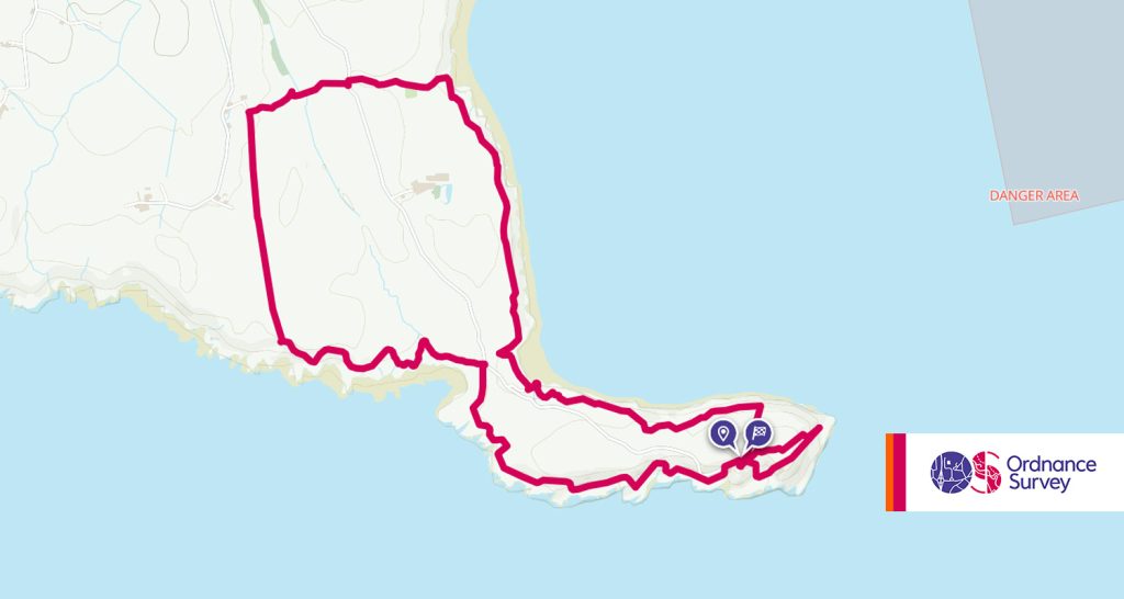
- Grade: Moderate
- Terrain: Open, Coastal
- Distance: 10.75km | Approx. Time: 3:20 hours
In the South West corner of Scotland, you’ll find the Mull of Galloway. Part of the Mull of Galloway trial which reaches from the Mull to Stranraer (35 miles), but for those wanting to take in a section of the trail, there is a great 6 mile walk at the Mull itself. The area offers stunning sea views, cliff walks, sea birds aplenty and a lighthouse for you to check out.
Maps to purchase for this route: OS Explorer 309: Stranraer & The Rhins / OS Landranger 82: Stranraer & Glenluce
You can download the route for this walk here.
12. Borth to Aberystwyth, Ceredigion, Wales

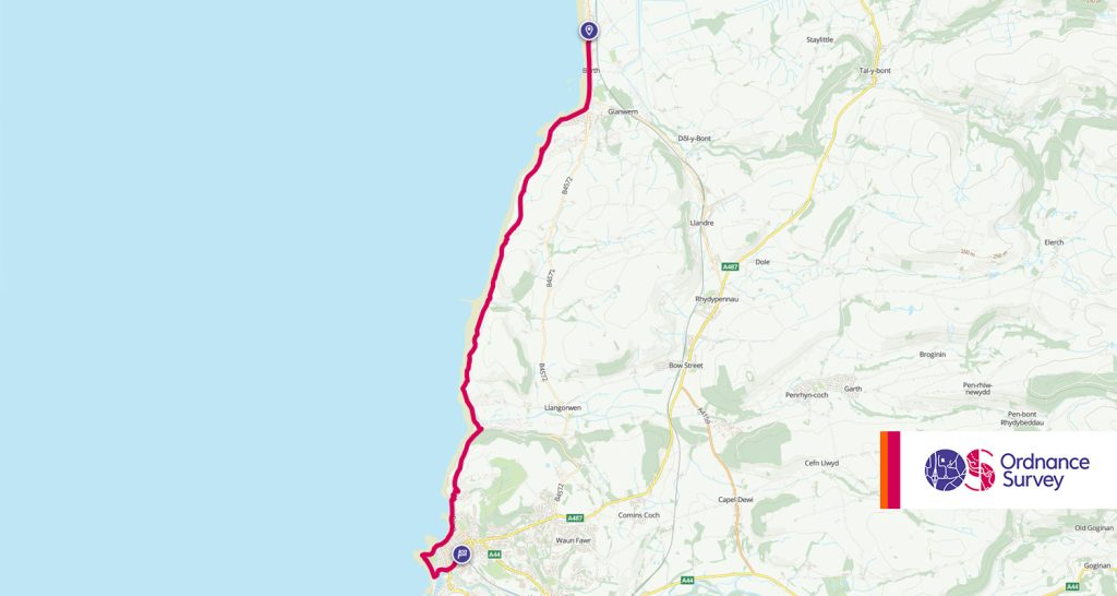
- Grade: Moderate
- Terrain: Open, Coastal
- Distance: 11.35km | Approx. Time: 3:50 hours
The Ceredigion Coast Path, part of the Wales Coast Path offers up the stunning views you’d expect and a great way to explore this side of Wales. The walk starts with tremendous views over Cardigan Bay, where you can see Snowdonia in the North when it’s clear enough. Along the way you’ll take in Wallog (an old mansion), the popular Clarach Bay and Constitution Hill on your way to Aberystwyth which still has plenty to offer.
This path is not for those with vertigo as it does sometimes get quite close to the cliff edge. A well run bus route is available at the other end to bring you back to the start.
Maps to purchase for this route: OS Explorer 213: Aberystwyth & Cwm Rheidol / OS Landranger 135: Aberystwyth & Machynlleth
You can download the route for this walk here.
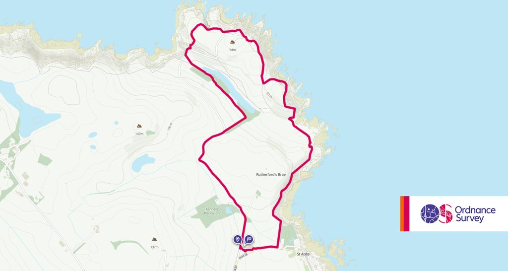
13. St Abb’s Head, Berwickshire, Scotland

- Grade: Moderate
- Terrain: Open, Coastal
- Distance: 5.75km | Approx. Time: 1:55 hours
St Abb’s head is a National Nature Reserve near the village of St Abb’s in Berwickshire. This walk is ideal for nature lovers, so bring your binoculars, and your camera. As well as a wealth of wildlife (There has been known to be plenty of Guillemots in the area) you’ll also find a lighthouse that has been in operation since 1862. This is a bracing but simple walk in some stunning coastal scenery.
Maps to purchase for this route: OS Explorer 346: Berwick-upon-Tweed / OS Landranger 67: Duns, Dunbar & Eyemouth
You can download the route for this walk here.
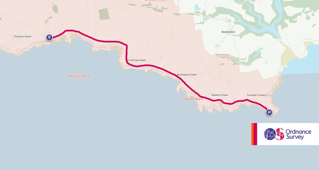
14. Stack Rocks to St Govan’s, Pembrokeshire, Wales

- Grade: Easy
- Terrain: Open, Coastal
- Distance: 5.85km | Approx. Time: 1:35 hours
A walk filled with photo opportunities on the glorious Pembrokeshire Coastline. Starting at Stack Rocks, you can also visit the famous Green Bridge of Wales nearby (though not part of this walk so a slight detour needed). The untouched nature of this area means it’s teaming with wildlife at varying times of year, so it’s worth bringing your binoculars.
The trail goes along Castlemartin Range and passes a number of bays on your way to St Govan’s church. The steps down to St Govan’s are said to never be the same number going down as they are coming up. Please note that as this trail goes over a military range, it is closed when training is happening. So do check ahead.
Maps to purchase for this route:
OS Explorer OL36: South Pembrokeshire / De Sir Benfro
OS Landranger 158: Tenby & Pembroke/Dinbyc-ypysgod a Penfro
You can download the route for this walk here.
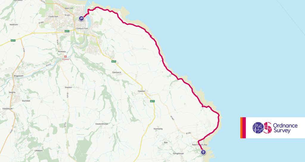
15. Robin Hood’s Bay to Whitby, Yorkshire, England

- Grade: Easy
- Terrain: Open, Coastal
- Distance: 11.65km | Approx. Time: 3:40 hours
Robin Hood’s Bay is a pretty little bay area in North Yorkshire for a day trip, but if you want to take in a cliffside walk all the way to Whitby and passing Whitby Abbey along the way? Then this well laid walk along the Cleveland Way is idea. At 7.5 miles, it may not be for everyone, but well worth the effort for the sea views, and the picturesque start and end points of Robin Hood’s Bay and Whitby
Maps to purchase for this route: OS Explorer OL27: North York Moors – Eastern area /
OS Landranger 94: Whitby & Esk Dale
You can download the route for this walk here.
Before heading off on your coastal walk, make sure you’re prepared with all the right clothing and equipment! Here at Go Outdoors we have everything you’ll need for all your outdoor adventures.
