Check out our top picks of UK waterfalls walks in the UK.
Water, dampness, it’s sort of what the UK really excels at, so it’s no surprise we have such an abundance of stunning lakes, rivers and yes waterfalls. If you’re planning a trip this year, why not check out some of these?
Waterfalls in films are often depicted as romantic, exotic locations (or the inevitable end to somebody being carried down a fast flowing river). We have some stunning waterfalls around the UK that you can visit, and some of them couldn’t be easier to reach. The best thing about waterfalls, is that they’re actually more impressive in the rain – so don’t let the great British weather hold you back.
In this blog we look at some of our favourite waterfalls around the UK, where they are and offer up a walk you can tackle to find them. Some are nearer than you think, so grab your walking boots and get exploring!
There are two options of map; OS Explorer has a scale of 1:25 000 and OS Landranger has a scale of 1:50 000. OS Explorer is more zoomed in and offers greater detail and information, but the OS Landranger covers a greater area.
If you’re planning you’re own route, but you’re not sure which map you need, then check out our Ordnance Survey online map finder here!
1. High Force, County Durham, England
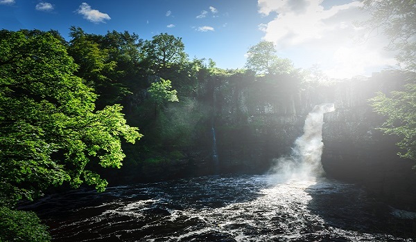

- Grade: Moderate
- Terrain: Open, Woodland, Rocky
- Distance: 11.05 km | Approx. Time: 3:20 hours
Now that’s a proper name for a waterfall, isn’t it? You can find High Force at Forest-in-Teesdale, High Force is very popular with visitors and has a visitor centre, car park and facilities that you can visit. High Force isn’t the tallest of England’s waterfalls, but it does have the highest volume of water falling over an unbroken drop. High Force stands at around 22 metres high.
Maps to purchase for this route: OS Explorer OL31: North Pennines / OS Landranger 92: Barnard Castle & Richmond
You can download the route for this walk here.
2. Falls of Glomach, Rosshire, Scotland
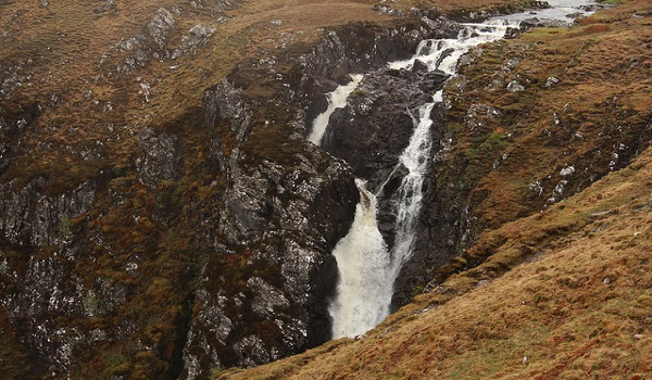
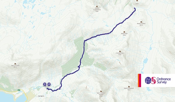
- Grade: Moderate
- Terrain: Open, Woodland, Hill
- Distance: 18.35 km | Approx. Time: 6:25 hours
With a drop of around 113 metres, the Falls of Glomach are one of the tallest in Britain, but you’re going to have to put the work in if you want to find them. The route we’ve chosen below to find these falls, is considered the easiest and still clocks in at 11 miles. It’s worth it though to visit one of the tallest single drop falls, and because it’s a little off the beaten track, it won’t be as busy with tourists. If the stunning falls aren’t enough to entice you, it’s also worth keeping an eye out for wild life such as: golden eagles, golden plover, herds of red deer and wild goats.
Maps to purchase for this route: OS Explorer 414: Glen Shiel & Kintail Forest / OS Landranger 33: Loch Alsh, Glen Shiel & Loch Hourn
You can download the route for this walk here.
3. Pistyll Rhaeadr, Powys, Wales


- Grade: Easy
- Terrain: Open
- Distance: 3.40 km | Approx. Time: 1:05 hours
Located just inside Wales in the Berwyn Mountains, near Owestry and Shrewsbury, Pistyll Rhaeadr is another one of the largest falls in the UK and is listed as one of the ‘Seven Wonders of Wales’. It’s relatively easy access for all abilities with a car park and tea room located at the bottom of the falls. There’s plenty of good walking to be had in the area, and much more than just the stunning fall to discover. Local legend has it that a winged serpent lived in the lake at the top of the falls, and would fly down into the local village to steal children, women or animals before eating them. So if the kids won’t behave, you could always let them know all about Gwybr of Llanrhaeadr (actually don’t, that’s probably a bit mean).
Maps to purchase for this route: OS Explorer 255: Llangollen & Berwyn / OS Landranger 125: Bala & Lake Vyrnwy / Y Bala a Llyn Efyrnwy
You can download the route for this walk here.
4. Steall Falls, Glen Nevis, Scotland


- Grade: Moderate
- Terrain: Open, Woodland, Rocky
- Distance: 3.30 km | Approx. Time: 1:10 hours
If you’re in the area for a holiday, or are looking for something other than Ben Nevis to occupy your time, then you really can’t go wrong with a lovely walk through Nevis Gorge to see Steall Falls. These walks are ideal for all abilities, but good footwear is recommended. The walk takes you past some lower falls to whet your appetite, through the gorge toward Steall Falls which can be seen from a wire bridge. This is Scotland’s second highest fall at 120m.
Maps to purchase for this route: OS Explorer 392: Ben Nevis & Fort William / OS Landranger 41: Ben Nevis
You can download the route for this walk here.
5. Hardraw Force, Yorkshire Dales, England
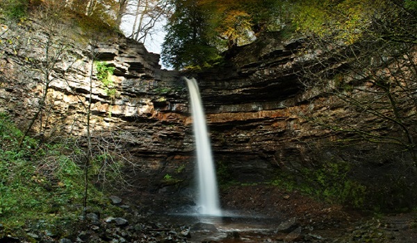

- Grade: Easy
- Terrain: Open, Hill
- Distance: 11.33 km | Approx. Time: 3:20 hours
It’s claimed that Hardraw Force is England’s highest unbroken overground waterfall at 30m high. Located just outside of Hardraw in the Yorkshire Dales, with the Pennine Way passing close by. A rather unique feature of Hardraw Force is that, to view it – you have to go through a pub called the Green Dragon Inn (sounds like a good excuse). For movie fans, this waterfall was used in the film Robin Hood: Prince of Thieves for the scene where Maid Marion catches Robin bathing under a waterfall (Please note: Nobody wants to see you re-create this).
Maps to purchase for this route: OS Explorer OL30: Yorkshire Dales – Northern & Central areas / OS Landranger 98: Wensleydale & Upper Wharfedale
You can download the route for this walk here.
6. Aira Force, Lake District, England


- Grade: Easy
- Terrain: Open, Hill
- Distance: 5.60 km | Approx. Time: 2:15 hours
Arguably the most famous fall in the Lake District, Aira Force is located in Matterdale. Aira Force is a popular fall so can get quite busy, but it’s worth a visit as you can take in the surrounding Ullswater area as well. It’s an approximately 22m fall with a car park near by for easier access.
Maps to purchase for this route: OS Explorer OL05: English Lakes – North-eastern area / OS Landranger 90: Penrith & Keswick
You can download the route for this walk here.
7. Ingleton Waterfall Trail, Yorkshire Dales, England
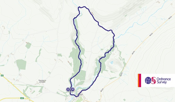
- Grade: Easy
- Terrain: Open, Woodland, Rocky
- Distance: 6.80 km | Approx. Time: 2:25 hours
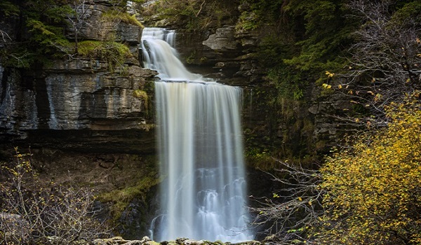
The Ingleton Waterfall Trail is a route in the Yorkshire Dales taking in a number of fantastic looking waterfalls including Pecca Falls, and the most famous of them all ‘Thornton Force’, a tropical looking 14 metre waterfall over a limestone cliff. The route is quite family friendly and is an ideal day out for a picnic, and well worth taking your camera.
Maps to purchase for this route: OS Explorer OL02: Yorkshire Dales – Southern & Western areas / OS Landranger 98: Wensleydale & Upper Wharfedale
You can download the route for this walk here.
8. Waterfall Country, Brecon Beacons, Wales


- Grade: Easy
- Terrain: Woodland
- Distance: 7.80 km | Approx. Time: 2:45 hours
Waterfall Country is the name commonly used to describe an area of the Brecon Beacons that features a number of waterfalls and the scenery carved out by years of rushing water. This area features the four falls walk, which is by far the most popular way to see the area. The most famous of all the falls in the area is probably Sgwd Yr Eira, due to the fact that you can actually walk behind the water.
Maps to purchase for this route:
OS Explorer OL12: Brecon Beacons National Park / Parc Cenedlaethol Bannau Brycheiniog
OS Landranger 160: Breacon Beacons/Bannau Brycheiniog
You can download the route for this walk here.
9. Becky Falls, Dartmoor, England

- Grade: Easy
- Terrain: Woodland
- Distance: 11.90 km | Approx. Time: 3:55 hours
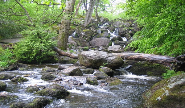
Becky Falls, or Becka Falls as it used to be known is a park attraction in stunning Dartmoor. While the falls are behind an admission, they’re part of a park that features lovely family walks and family activities such as competitions and even a Meet the Meerkats experience. The falls mark a natural centrepiece as the water cascades over boulders to a roughly 20m drop. Becky Falls would make a great day out for young families.
Maps to purchase for this route: OS Explorer OL28: Dartmoor / OS Landranger 191: Okehampton & North Dartmoor
You can download the route for this walk here.
10. St. Nectan’s Glen, Cornwall, England

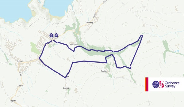
- Grade: Easy
- Terrain: Open, Woodland
- Distance: 7.35 km | Approx. Time: 2:20 hours
Not far from Tintagel in North Cornwall, you’ll find magical St Nectan’s Glen and area of woodland that features a number of waterfalls, including the 60 ft Nectan’s Kieve (above), which over time has punched a hole through the rocks. To reach the waterfalls, the glen will take you on a pretty walk through Ivy clad trees along the River Trevillet. The Kieve is considered a sacred place to some, and as you can see from the image above, the area now features numerous ribbons, crystals, inscriptions, prayers and more all over the rock and foliage near the fall.
Maps to purchase for this route: OS Explorer 111: Bude, Boscastle & Tintagel / OS Landranger 200: Newquay & Bodmin
You can download the route for this walk here.
11. The Falls of Clyde, South Lanarkshire, Scotland


The Falls of Clyde is the collective term for the four linn along the River Clyde, they comprise of: Bonnington Linn, Corra Linn, Dundaff Linn and Stonebyres Linn with Corra Linn (pictured) the largest. The reserve where these falls can be found is known for woodland walks and a wealth of wildlife including: Peregrine falcons, otters, badgers and roe deer, in fact over 100 species of bird have been spotted in the area over time. The Clyde Walkway long distance walking route passes through the reserve and will take you past all four falls.
- Grade: Easy
- Terrain: Open, Woodland
- Distance: 7.35 km | Approx. Time: 2:20 hours
Maps to purchase for this route: OS Explorer 335: Lanark & Tinto Hills / OS Landranger 71: Lanark & Upper Nithsdale
You can download the route for this walk here.
12. Hareshaw Linn, Northumberland, England

- Grade: Easy
- Terrain: Woodland
- Distance: 4.75 km | Approx. Time: 1:30 hours
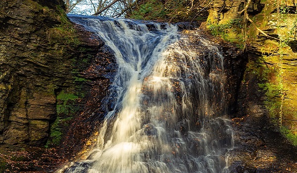
Hareshaw Linn is a pretty little wooded valley that features a 3 mile there and back walk that captures a waterfall. This is a relatively easy walk and is suitable for most abilities. Look out for a wealth of wildlife such as great spotted woodpeckers and red squirrels.
Maps to purchase for this route: OS Explorer OL42: Kielder Water & Forest / OS Landranger 80: Cheviot Hills & Kielder Water
You can download the route for this walk here.
13. Fairy Pools, Glenbrittle, Isle of Skye

- Grade: Moderate
- Terrain: Woodland
- Distance: 7.55 km | Approx. Time: 2:40 hours
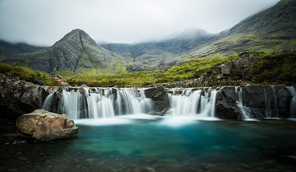
A very popular location on the Isle of Skye, ideal for walkers and wild swimmers alike. the Fairy Pools are vivid blues and greens and although the falls may not be as large as some on this list, they make for an all together magical experience. The first waterfall on the walking route actually marks the start of the Fairy Pools experience as you can explore through a landscape that is well worth packing a second camera battery for.
Maps to purchase for this route: OS Explorer 411: Skye – Cuillin Hills / OS Landranger 32: South Skye & Cuillin Hills
You can download the route for this walk here.
14. Glenoe Waterfall, County Antrim, Northern Ireland
- Grade: Easy
- Terrain: Woodland
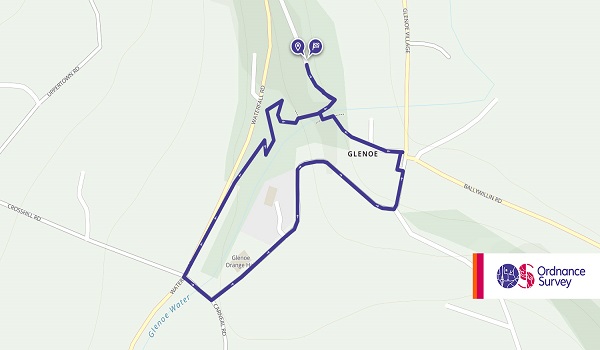
- Distance: 0.95 km | Approx. Time: 0:20 hours
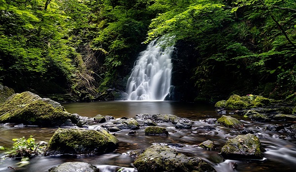
Arguably one of the most picturesque waterfalls in Northern Ireland, Glenoe Waterfall is a short walk from the village of Glenoe in County Antrim. The short walk weaves it’s way through the glen to one of the most favoured photo spots in County Antrim.
You can download the route for this walk here.
15. Henrhyd Falls, Brecon Beacons, Wales


- Grade: Easy
- Terrain: Woodland
- Distance: 5.25 km | Approx. Time: 2:05 hours
Not too far from ‘Waterfall Country’ mentioned above you will find Henrhyd Falls, the tallest waterfall in south Wales. While it’s certainly impressive in it’s own right, this is another waterfall for movie buffs, as it was actually used as the waterfall protecting the Batcave in Batman ‘The Dark Knight Rises’. The area can get quite slippery with spray, so be careful when visiting, and unfortunately we have to say – The Batcave isn’t actually behind the waterfall (But then I suppose that’s what Batman would want us to think).
Maps to purchase for this route:
OS Explorer OL12: Skye – Brecon Beacons National Park / Parc Cenedlaethol Bannau Brycheiniog
OS Landranger 160: Breacon Beacons/Bannau Brycheiniog
You can download the route for this walk here.
Now this is only a select 15 of the fantastic waterfalls around the UK that you can visit, and in the interest of trying to spread out the locations, we’ve probably missed off some quite popular ones. For example, there are plenty in the Yorkshire Dales that we could have named, along with even more in Wales. That being said, you can view a lot of waterfall walks here.
Before setting off to explore one of these fantastic waterfalls, make sure you have everything you need! Here at Go Outdoors we stock everything you need for all your outdoor adventures.
Looking for more inspiration? Head to our blog to read more unbeatable content from us!
