
We’ve compiled some of our favourite walks from various National Parks, to create our Best 20 Walks in the UK! Plus, we spoke to our North Ridge and Peter Storm ambassadors, who alongisde introducing their new Autumn/Winter collections, have told us their favourite walks!


The UK has many areas of natural beauty, as well as magnificent National Parks, which boast an array of walks that cater to every taste and skill level. The picturesque landscape of the Peak District, the rugged terrains of the Scottish Highlands, and the serene paths along the Cornish coast; these are just some of the magnificent areas that the UK has to offer. Whether you crave the challenge of mountainous trails, the tranquillity of lakeside strolls, or the historical fascination of ancient landmarks, we’ve pulled together our favourite walks from 8 National Parks around the UK!
Plus, our brand ambassadors for North Ridge – Helen Skelton and Gethin Jones and our brand ambassadors for Peter Storm – Julia Bradbury and Sean Fletcher have told us their favourite walks!
Grab your jacket, lace your boots and discover our Top 20 UK Walks below!
Head straight to our ambassadors favourite walks here or continue scrolling…
Helen Skelton’s Favourite Walk
Julia Bradbury’s Favourite Walk
Sean Fletcher’s Favourite Walk
Use our handy navigation list to find routes in your favourite National Parks:
Lake District National Park
Helvellyn Gill Path, Lake District, England – Helen Skelton’s Favourite Walk

We asked Helen why this is her favourite walk in the Peak District:
I just love this walk. Many memories, many early mornings and many milestones have been marked here for me! Walking around here brings such a wholesome feeling to me and I am so grateful to have this, and many other locations in the Lake District, on my doorstep!
Helen Skelton, North Ridge Brand Ambassador


- Grade: Difficult
- Terrain: Mountain, Open
- Distance: 7.15 km | Approx. Time: 3 hours
Wind your way around the Helvellyn Gill Path right to the top of the mountain to experience breath taking views of the Lake District. We found this moderately difficult walk to be popular with dog owners – it will take around 3 hours to complete so be sure your dog is in peak fitness.
Maps to purchase for this route: OS Explorer OL05: English Lakes – North-eastern area / OS Landranger 90: Penrith & Keswick
You can download the route for this walk here.
Tarn Hows, Lake District, England


- Grade: Easy
- Terrain: Woodland, Open, Lake
- Distance: 2.85 km | Approx. Time: 0:50 hours
If you don’t want to be huffing and puffing your way around the Lakes, opt for the more relaxing Tarn Hows, which offers an accessible route for all, whether you’ve got a pushchair in tow or one of your party is wheelchair-bound. We love that there’s plenty of stunning scenery and rest stops along the way so you can take it as easy as necessary.
Maps to purchase for this route: OS Explorer OL07: English Lakes – South-eastern area / OS Landranger 90: Penrith & Keswick
You can download the route for this walk here.
Latrigg Walk via Keswick


- Grade: Moderate
- Terrain: Mountain, Open
- Distance: 8.95 km | Approx. Time: 2:55 hours
Journey the six miles over Keswick’s personal fell, Latrigg to experience some truly stunning scenery. With steep inclines along the way, we recommend this route for more experienced walkers. Starting from Moot Hall, Keswick and climbing 1,000 feet, it should take you around three hours to complete – any less and we salute you as champion fell walker.
Maps to purhcase for this route: OS Explorer OL04: English Lakes – North-western area / OS Landranger 90: Penrith & Keswick
You can download the route for this walk here.
Peak District National Park
Kinder Scout from Edale – Gethin Jones’ Favourite Walk in the Peak District!

We asked Gethin why this is his favourite walk in the Peak District:
I was introduced to this walk by my friend Will. And because it was that time during lockdown where being outdoors was more important than ever, the fact that’s it’s a good 4 hours really didn’t matter. I think mentally it was just wonderful to pack a few snacks and the right gear and off we went. A tram from Manchester and within 20 odd mins, just surrounded by beauty. Freedom!
Gethin Jones, North Ridge brand ambassador


- Grade: Difficult
- Terrain: Open
- Distance: 15.70 km | Approx. Time: 4:55 hours
Feel the wind in your hair as you take the nearly 10 mile mile hike from Edale village across the famous Kinder Scout. With some complicated climbs and difficult descents along the way, make sure you pack your sturdiest walking boots. You may want to take a packed lunch or some light refreshments too as it’ll take you around five hours to complete.
Maps to purchase for this route: OS Explorer OL01: Peak District – Dark Peak area / OS Landranger 110: Sheffield & Huddersfield
You can download the route for this walk here.
Castleton to Mam Tor


- Grade: Moderate
- Terrain: Open, Hill
- Distance: 9.10 km | Approx. Time: 3 hours
For a relatively easy five mile route, look no further than Mam Tor. This famous Peak District hill dates back as far as the Bronze Age and much of the area’s natural history can still be seen today. Ideal if you only have a short time in which to explore, this walk should take around 3 hours to complete.
Maps to purchase for this route: OS Explorer OL01: Peak District – Dark Peak area / OS Landranger 110: Sheffield & Huddersfield
You can download the route for this walk here.
Ladybower Wood Circular Walk


- Grade: Easy
- Terrain: Open, Woodland, Hill
- Distance: 6.70 km | Approx. Time: 2:10 hours
A gem of a reserve covering the steep valley side overlooking Ladybower reservoir, this walk is an incredibly important refuge for a number of resident and migrant woodland birds. In the spring and summer the wood is full of bird song from pied flycatchers, redstarts, wood warblers and tree pipits as well as blue tits, treecreepers and nuthatches. Higher up valley side the woodlands give way to bracken and heather moorland where you may spot grouse, meadow pipits, curlew and occasionally hares.The reserve is also great for botanists looking to seek out fungi, mosses, liverwort, and lichens. Over 75 lichen species have been recorded making it one of the best sites in the Peak District to find them
Maps to purchase for this route: OS Explorer OL01: Peak District – Dark Peak area / OS Landranger 110: Sheffield & Huddersfield
You can download the route for this walk here.
Snowdonia National Park
The Snowdon Horseshoe


- Grade: Difficult
- Terrain: Mountain, Open
- Distance: 14.70 km | Approx. Time: 5:55 hours
With a combination of steep slopes and exposure to the elements, the Snowdon Horseshoe is sure to get your pulse racing. Dubbed ‘the best ridge walk in Wales’, this 14km route is not suitable if you have a fear of heights. It takes up to six hours to complete so you might want to pack some refreshments for the journey.
Maps to purchase for this route: OS Explorer OL17: Snowdon / Yr Wyddfa
OS Landranger 115: Snowdon/Yr Wyddfa
You can download the route for this walk here.
Crib Goch to Snowdon


- Grade: Difficult
- Terrain: Mountain, Open
- Distance: 5.05 km | Approx. Time: 2:45 hours (one-way)
If you’re one for a challenge, then Crib Goch may be just the route for you. Not one for novice walkers, it’s a thrilling combination of grade one scrambling, steep slopes and slippery rock. Tackle three summits in one day: Crib Goch, Garnedd and Snowdon. It is not recommended to attempt this route in wet weather conditions or during the winter unless very experienced and equipped with crampons and ice axes.
Maps to purchase for this route: OS Explorer OL17: Snowdon / Yr Wyddfa
OS Landranger 115: Snowdon/Yr Wyddfa
You can download the route for this walk here.
New Forest National Park
Tall Trees Trail – Julia Bradbury’s Favourite Walk!

We asked Julia Bradbury why this walk is her favourite in New Forest National Park:
Being surrounded by trees is one of my favourite parts of being outdoors, especially when it’s the Giant Redwood trees! These are the biggest trees in New Forest National Park, and they can be seen on the Tall Trees Trail, one of the main reasons why I absolutely love this walk. As I always say, trees are our companions, and seeing these magnificent Giant Redwoods on this route is truly magnificent.
Julia Bradbury, Peter Storm Brand Ambassador


- Grade: Easy
- Terrain: Woodland
- Distance: 3.10 km | Approx. Time: 0:50 hours
Discover the enchanting beauty of New Forest’s Tall Trees Trail, an idyllic route that meanders through the heart of England’s ancient woodlands. Nestled within the picturesque New Forest National Park, this trail offers a captivating journey through a diverse tapestry of towering trees, lush ferns, and delicate wildflowers. The trail showcases the magnificence of nature’s giants, with towering Douglas firs, majestic oaks, and lofty beech trees lining the path. Whether you’re a seasoned hiker or a nature enthusiast seeking solace, the Tall Trees Trail promises an unforgettable experience, immersing you in the timeless beauty of New Forest’s remarkable woodlands.
Maps to purhcase for this route: OS Explorer OL22: New Forest / OS Landranger 195: Bournemouth & Purbeck
You can download the route for this walk here.
Keyhaven to Hurst Castle


- Grade: Easy
- Terrain: Open, Coastal
- Distance: 7.40 km | Approx. Time: 1:55 hours
Taking you from the pretty hamlet of Keyhaven, on the coast of Hampshire, along to one of the area’s most iconic landmarks, Hurst Castle. This scenic route is a fantastic way to enjoy stunning views over the water front. Leading along a section of the Solvent Way, the walk leads across mainly flat terrain and so is graded easy. Once you reach the castle, you can explore the historic building and take-in the view across to the Isle of Wight, before heading home on the Hurst Castle Ferry.
Map to purchase for this route: OS Explorer OL22: New Forest / OS Landranger 196: The Solent & Isle of Wight
You can download the route for this walk here.
Wilverley Inclosure Walk


- Grade: Easy
- Terrain: Woodland
- Distance: 5.25 km | Approx. Time: 1:25 hours
Easily accessible, with parking and the beginning of the route just off the A35, the Wilverley Inclosure Walk is a popular path through New Forest National Park.The trail takes in plenty of the Ancient and Ornamental Woods, so keep your eyes peeled for the fallow deer that live in this part of the forest, and course the free grazing cattle and ponies too. If you’re planning a trip around the Wilverley Inclosure Walk, be sure to factor in some time to stop for tea and a cake at the Old Station Tea House along the way.
Maps to purchase for this route: OS Explorer OL22: New Forest / OS Landranger 195: Bournemouth & Purbeck
You can download the route for this walk here.
Yorkshire Dales National Park
Yorkshire Three Peaks Challenge


- Grade: Moderate
- Terrain: Open, Mountain
- Distance: 39.00 km | Approx. Time: 12:30 hours
If you talk to any experienced walker they’ll tell you that the Three Peaks in the Yorkshire Dales are a must. In terms of challenging terrain and beautiful scenery they don’t come any better in the region, but you’d best come prepared! This walk across the three biggest mountains in the county of Yorkshire covers 24 miles and may take anything up to 14 hours to complete, so be sure to pack your best boots and waterproofs – you don’t want to get caught out by changeable weather.
Maps to purchase for this route: OS Explorer OL02: Yorkshire Dales – Southern & Western areas / OS Landranger 98: Wensleydale & Upper Wharfedale
You can download the route for this walk here.
Ingleton Waterfall Trail


- Grade: Easy
- Terrain: Open, Woodland, Rocky
- Distance: 6.80 km | Approx. Time: 2:20 hours
Wander through beautiful green woodland and you’ll come across what have been declared as England’s “most spectacular waterfalls.” A must-see for any walker taking in the Dales, the waterfalls of Ingleton are truly a sight to behold. The walk is filled with wonderful sights throughout the 4.5 miles, with plenty to see in addition to the falls and places to stop to grab a bite to eat too – or you could always find a safe spot for a swim to cool off on a hot day!
Maps to purchase for this route: OS Explorer OL02: Yorkshire Dales – Southern & Western areas / OS Landranger 98: Wensleydale & Upper Wharfedale
You can download the route for this walk here.
Cairngorms National Park
Ben Macdui and Cairngorm


- Grade: Moderate
- Terrain: Open, Mountain
- Distance: 17.84 km | Approx. Time: 6:05 hours
No trip to the Cairngorm National Park is complete without attempting to reach the summit of the two most iconic peaks in the region. Ben Macdui is the second-highest peak in the whole of the UK, behind Ben Nevis, and it is well worth the hours spent trekking to the top for the incredible views over the region. Similarly, the Cairngorm mountain is a highlight and key feature of the park. The ascents take around six to eight-hours depending on your experience and ability, covering almost 11-miles from the starting point at the ski centre.
Maps to purchase for this route: OS Explorer OL57: Cairn Gorm & Aviemore / OS Landranger 36: Grantown & Aviemore
You can download the route for this walk here.
Cateran Trail: Alyth to Blairgowrie (via the Bridge of Cally)


- Grade: Moderate
- Terrain: Open
- Distance: 24.45 km | Approx. Time: 7:10 hours (one-way)
The Cateran Trail is one that you’re likely to see signposted throughout the national park. Covering a total of 63-miles in one large loop, the route goes from high to low – and back again! The section from Alyth to Blairgowrie is a challenging section that takes in the wonderful Bridge of Cally during the 15-mile moderate walk. Taking between six and seven hours to complete, this section of the trail is popular among keen and amateur walkers alike.
Maps to purchase for this route: OS Explorer 381: Blairgowrie, Kirriemuir & Glamis / OS Landranger 53: Blairgowrie & Forest of Alyth
You can download the route for this walk here.
Loch Lomond & Trossachs National Park
Loch Katrine


- Grade: Moderate (Due to Length)
- Terrain: Lake
- Distance: 21.0km | Approx. 6:15 hours
Loch Katrine is a freshwater loch in the Loch Lomond and Trossachs National Park. The loch is 8.1miles long and 0.62 miles wide at the widest point and is a key water source for the city of Glasgow. To start the walk, you will need to book with Loch Katrine Cruises and purchase a ticket to Stronachlachar pier. There you can depart the boat and walk back along the shore road; the road is private offering a secluded and peaceful walk back. If you book the Sir Walter Scott Steamship, you will be able to look down into the engine room.
Maps to purchase for this route (centered between two map sheets): OS Explorer OL46: The Trossachs / OS Explorer OL39: Loch Lomond North and OS Landranger 56: Loch Lomond & Inveraray / OS Landranger 57: Stirling & The Trossachs
You can download the route for this walk here.
Ben Lomond


- Grade: Easy
- Terrain: Mountain
- Distance: 6.3 km | Approx. Time: 3:40 hours
With gentle terrain and little navigation required, Ben Lomond is one of the easiest Munros – in fact, it’s so popular with walkers that it’s one of Scotland’s most-climbed hills, second to Ben Nevis. If you’re looking for a more peaceful stroll, there are several alternative routes to try which are less populated, such as the Ptarmigan route which offers a fine descent.
Maps to purchase for this route: OS Explorer OL38: Loch Lomond South / OS Landranger 56: Loch Lomond & Inveraray
You can download the route for this walk here.
Pembrokeshire Coast National Park
St David’s, Porth Clais, and Ramsey Sound – Sean Fletcher’s favourite walk!

We asked Sean why this is his favourite walk in the Pembrokeshire Coast National Park:
Pembrokeshire Coast is a truly amazing place. Taking in the sea air whilst walking is something I love about being outdoors, and this walk provides me with exactly that. There’s not much more I could ask for than beautiful scenery and fresh sea air!
Sean Fletcher, Peter Storm Brand Ambassador


- Grade: Moderate
- Terrain: Open,Coastal
- Distance: 14.65 km | Approx. Time: 4:15 hours
From the delightful town of St. David’s, it’s just a mere half-mile (800 meters) to the coast, and then the real adventure begins! The path will take you on a journey from the enchanting St. Non’s Bay to the picturesque Porthstinian. Brace yourself for a wild, breathtaking, and wonderfully solitary stretch of shoreline which is also relatively easy for walking with its well-marked path and just a handful of modest ascents and descents.
Maps to purchase for this route: OS Explorer OL35: North Pembrokeshire / Gogledd Sir Benfro
OS Landranger 157: St Davids & Haverfordwest/Tyddewi a Hwlffordd
You can download the route for this walk here.
Tenby to Saundersfoot

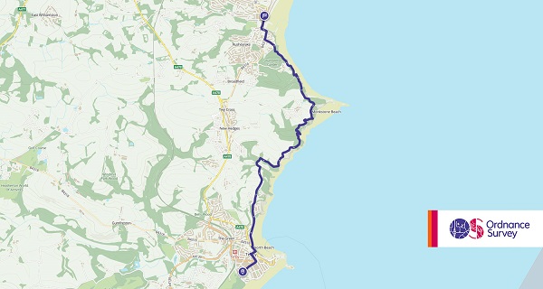
- Grade: Easy
- Terrain: Open, Coastal
- Distance: 6.79 km | Approx. Time: 2:12 hours (one-way)
This fabulous jaunt connects the dots between the two most popular resorts on the south Pembrokeshire coast: Saundersfoot and Tenby. Starting off in Saundersfoot, you’ll embark on a journey along a breath-taking, and often well-wooded section of the coastal path. As you progress, get ready for jaw-dropping views of Tenby, a charming and captivating town that’s just begging to be explored once you reach the finish line. On weekdays and Saturdays, hop on a bus between Tenby and Saundersfoot, and on Sundays, let the train whisk you away. Lace up those walking shoes and get ready for a South Pembrokeshire adventure that’s equal parts scenic and convenient!
Maps to purchase for this route: OS Explorer OL36: Alnwick & Amble – South Pembrokeshire / De Sir Benfro
OS Landranger 158: Tenby & Pembroke/Dinbyc-ypysgod a Penfro
You can download the route for this walk here.
Newport Millennium Trail


- Grade: Easy
- Terrain: Open
- Distance: 7.20 km | Approx. Time: 2:10 hours
To celebrate the millennium back in 2000 the Newport Millennium Trail was opened to attract walkers to the area and it has gone on to become one of the most popular in the National Park. It is a circular route that starts and ends in Newport with walkers taking on a 5-mile loop through wooded, mountainous terrain. It’s a walk that is suitable for beginners right through to more experienced walkers but one that the whole family can enjoy.
Maps to purchase for this route: OS Explorer OL35: North Pembrokeshire / Gogledd Sir Benfro
OS Landranger 145: Cardigan & Mynydd Preseli/Aberteifi a Mynydd Preseli
You can download the route for this walk here.
Looking for more inspiration? Head to our blog to read more unbeatable content from us!
